Streamlining Property Insurance with Self-Service Workflows and Video Technology
As extreme weather events such as hurricanes become more frequent, property insurers are under increasing pressure to process claims quickly and accurately. Leveraging self-service workflows and video technology allows insurers to streamline the claims process, improve customer experience, and enhance decision-making. From initial loss reporting to complex damage assessments, digital tools help insurers collect the right information at the right time – while also mitigating fraud risks and optimizing operational efficiency.
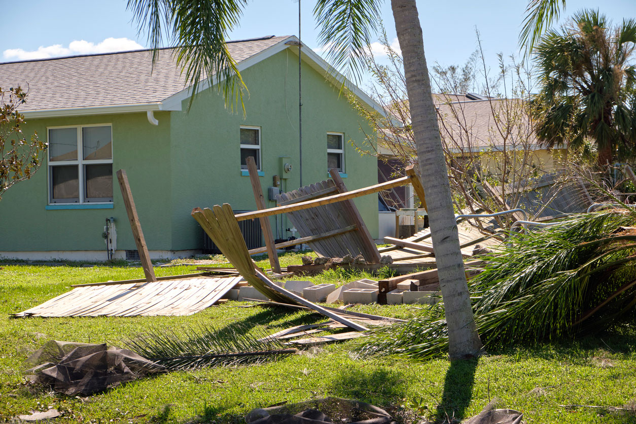
Handling Hurricane Damage with Self-Service FNOL
Imagine a homeowner reports damage after a hurricane has passed through their area. Using a
self-service workflow, they can quickly submit a First Notice of Loss (FNOL) by providing images of
their damaged roof and exterior, along with a geolocation tag from their mobile device. The
intuitive, guided process ensures that all critical information – such as the extent of
visible damage, time of the event, and property details – is captured efficiently.
With this structured data, the insurer can immediately assess the claim, confirm the event’s
proximity to the hurricane’s path, and initiate the appropriate next steps without delay. This rapid
response minimizes processing time and reassures the policyholder that their claim is being handled
efficiently.
Addressing Complex Water Intrusion Claims with Triage Options
In cases of more complex damage – such as water intrusion caused by storm-related flooding –
self-service FNOL submission is just the first step. A homeowner may report issues such as water seeping
into walls and floors using a self-service workflow, submitting photos and descriptions. However, due to
the complexity of water damage, insurers must decide on the next course of action through an efficient
triage process.
In such cases, insurers have multiple options:
Onsite Adjuster Deployment
If the initial submission suggests extensive damage requiring in-depth evaluation, an adjuster can be dispatched to assess the property in person.
Video Call Assessment
If the information provided needs further validation but an onsite visit isn’t immediately necessary or there is shortage on adjusters, a live video call can be conducted with the homeowner. This allows adjusters to guide them in capturing additional visual evidence, such as checking moisture levels, inspecting hidden areas, or verifying damage severity.
Decision Confirmation
If the evidence is clear and sufficient, the insurer can proceed directly with claim approval or recommend preventive measures before repairs commence.
By offering these flexible triage options, insurers can optimize resource allocation and deliver faster resolutions while ensuring claims are accurately assessed.
Validating Claims with your Hurricane Footprints
Combining self-service data with natural catastrophe (NatCat) footprint data – such as wind speed maps and flood models – adds another layer of validation to the claims process. By comparing the geolocation data submitted during FNOL with the actual hurricane impact footprint, insurers can verify whether the reported damages align with the recorded event conditions.
For example, if a claim for severe roof damage is filed in an area where wind speeds did not exceed moderate levels, further investigation may be warranted before proceeding with repairs. This validation helps insurers prioritize legitimate claims and allocate resources more effectively.
Fraud Detection Through Precise Geolocation Data
Accurate geolocation data, captured both during underwriting and claims processing, plays a crucial role in fraud detection. When a policyholder submits a claim, insurers can compare the geolocation of the reported damage with the originally insured property location.
If discrepancies arise – such as a claim being filed from a different location than what was insured – this can serve as an early warning sign for potential fraud. By integrating precise location tracking at the underwriting stage, insurers can ensure that claims are legitimate and that policies are being applied correctly to the insured property.
Key Benefits of Self-Service and Video Technology
Insurers can unlock numerous benefits by incorporating self-service workflows and video technology into their property claims processes:
Faster Claims Resolution
Streamlined data collection reduces processing time and allows for quicker triage decisions.
Enhanced Customer Experience
Policyholders can report damage at their convenience, with clear guidance and minimal hassle.
Improved Accuracy
High-quality images, videos, and geolocation data provide a clearer picture of the damage, reducing errors and guesswork.
Scalable Implementation
Insurers can start small, introducing self-service workflows for simple claims, and gradually expand to more complex cases with video support and AI integration.
Start Small and Scale Gradually
The transition to digital claims handling doesn’t have to happen all at once. Insurers can begin by implementing self-service FNOL for minor property damage and progressively extend their capabilities to include video inspections and deeper system integrations. Step by step, these enhancements build toward a fully automated, efficient claims process.
Ready to modernize your property claims handling?
Reach out to DLEGATE to explore how self-service workflows and video technology can transform your processes – one step at a time.